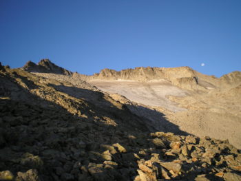
The northern route starts at La Besurta, located at 1,900 metres above sea level, and comprises the classic ascent of Aneto via its north face. From here, a 1,500-metre climb over challenging high-mountain terrain awaits you.
Northern route
The route begins at La Besurtaand starts by taking the well-marked GR 11.5 (red and white markings, 50 min) to La Renclusa (2,140 m). We recommend splitting the journey up into two days and spending the night at the refuge in order to allow your body to get used to the altitude.
Download the track and the map of this route.
La Renclusa refuge
There is no official trail from La Renclusa (2,140 m) to the summit, and instead you will have to follow the stone markers up to Portillón Inferior (2,736 m), stopping when you get there and not passing through (1 hr and 50 min). Continue beneath the Cresta de los Portillones ridge until you reach Portillón Superior (2,895 m, 30 min), where you will cross over to the other face of the mountain, all while taking in the fantastic views of Aneto Glacier.
Once you have passed Portillón Superior, go down a few metres before climbing once again and heading towards Collado de Coronas. The snow will be closer or further away depending on the time of year. Once you reach the snow, get out and equip your ice axe,crampons and helmet. Cut diagonally up the glacier or névé to reach Collado de Coronas (3,208 m, 1 hr and 20 min). Avoid the blue ice of the glacier beneath the névé at all costs.
The glacier
You will need to use crampons and an ice axe to cross the glacier, no matter the time of year. Do not attempt to cross it if you do not have this equipment with you or if you do not know how to use it. If this is the case, hire the services of a professional guide to help with your ascent.
Once you have reached Collado de Coronas, where you cross over the route that starts from the south, you will now have to climb the steepest part of the glacier up to the sub-peak, followed by Puente de Mahoma, from where you can reach the summit of Aneto (3,404 m, 40 min).
The final hurdle
Puente de Mahoma is the final obstacle that you must overcome before reaching Aneto. It is a narrow and exposed horizontal section where you have to climb up some rocks. During the final few metres, you may experience a feeling of queasiness; however, do not continue if you are afraid of heights. The amount of people on the pass and accumulated exhaustion may affect your safety while there. The sub-peak is also a breathtaking recompense.
Return
To get back down, follow the same route back to La Renclusa refuge before ending up in La Besurta (3 hr and 50 min). If you do not need to go back to the refuge, you can head instead for Basa d’el Salterillo and the bottom of the Barrancs Valley (where you will again find the GR 11.5 route), before reaching Plan d´Aiguallut and La Besurta (this is best in summer).
| Partial time | Time Total | Partial incline | Desnivel acumulado | Total incline | Total distance | |
| La Besurta – Refugio de La Renclusa | 50 min | 50 min | + 240 m | + 240 m | 1,8 km | 1,8 km |
| Refugio de la Renclusa – Portillón Inferior | 1 h 50 min | 2 h 40 min | + 600 m | + 840 m | 1,9 km | 3,7 km |
| Portillón Inferior – Portillón Superior | 30 min | 3 h 10 min | + 160 m | + 1000 m | 0,6 km | 4,3 km |
| Portillón Superior – Collada Corones | 1 h 20 min | 4 h 30 min | + 360 m | + 1360 m | 2,7 km | 7,0 km |
| Collada Corones – Pico Aneto | 40 min | 5 h 10 min | + 190 m | + 1550 m | 0,6 km | 7,6 km |
| Regreso | 3 h 50 min | 9 h | – 1 550 m | 0 m | 7,6 km | 15,2 km |
| Getting there | What to wear |
